Kamchatka: reading a landscape still taking shape
Volcanoes, water and wildlife: a closer look at the peninsula beyond a checklist of superlatives.
Landscapes, history and everyday life · 3 min read
Published 24 September 2026
.jpg)
In Kamchatka, a landscape rarely feels like a finished backdrop. Dark lava surfaces, snowy slopes and river channels offer different ways to read the same place. A useful opening question is simple: what was shaped by water, and what owes its form to heat from inside the Earth?
This feature connects the peninsula’s natural processes for first-time readers and people revisiting familiar photographs. It is an introduction to observation, not a current route advisory. Check the rules of the particular protected area before planning a visit.
A system rather than a single volcano
UNESCO’s Volcanoes of Kamchatka property comprises six areas. Its significance includes varied volcanic landforms, the interaction of volcanoes and glaciers, and exceptional wildlife. The name does not refer to one visitor park with a single entrance.
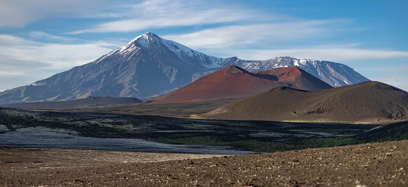
Try dividing a photograph into foreground, slope, summit and sky. Compare the colour and texture of each surface. This is an editorial exercise in looking carefully, not a way to date rocks: establishing their age requires scientific investigation.
Why geology belongs beside living nature
UNESCO also highlights the diversity of salmonid fish and the presence of brown bears, sea otters and Steller’s sea eagles. An account of Kamchatka limited to spectacular summits would miss much of what makes the region distinctive.
Choose one subject for a closer look: a river valley, a coast or a volcanic landscape. Then use the protected area’s description to trace connections between water, vegetation and animals. You begin to remember a habitat rather than simply a scenic background.
Understanding protected-area visits
Kronotsky Reserve explains that tour operators assemble visitor groups, while the reserve provides infrastructure and accompaniment. Visitor numbers are limited, and people must remain on the boardwalks along equipped routes.
Before choosing a programme, identify the exact protected area, seasonal restrictions, accompaniment arrangements and postponement terms. The Valley of Geysers, Uzon and Kurile Lake are distinct destinations; their names should not be treated as interchangeable stops on a short walk.
Bring home a question as well as a photograph
After exploring a place, note three things: what you observed, how a reliable source explains it, and what you still want to understand. A striking cloud above a summit, for example, does not by itself tell you which process produced it.
Our photograph shows Tolbachik and its volcanic plateau. The portal’s atlas connects this broad view with a Kamchatka profile; the reserve’s own resources offer the next step. An image becomes more rewarding when curiosity gives it context.
Sources & context
A russia.direct editorial selection based on open sources. Checked 24 September 2026. Practical suggestions are a decision guide, not a promise of outcomes.
Editorial principles