Derbent: reading history between mountains and sea
Naryn-Kala, the city walls and lived-in neighbourhoods offer three ways to understand the city.
Landscapes, history and everyday life · 3 min read
Published 24 September 2026
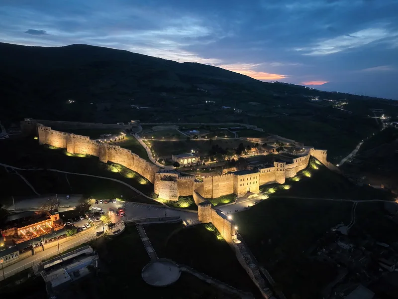

In Derbent, geography makes history easier to understand. Look first at the city’s position between mountains and the Caspian Sea, and the fortress gains a clear purpose. Stone walls become part of a much larger spatial system rather than an isolated attraction.
Do not let the citadel gates mark the end of that encounter. Everyday life continues around the monuments. A thoughtful introduction brings architecture and museum interpretation together with respect for the people whose neighbourhoods visitors are exploring.
Why this particular place mattered
UNESCO describes Derbent as a strategic passage on the western Caspian coast. Two parallel defensive walls linked the upland position with the shore, and the city developed between them. Parts of its historic structure still make that relationship legible.
Study an overview and imagine a line running from the heights to the sea. Compare it with a map of the old neighbourhoods. This simple spatial exercise can explain more than a long sequence of dates presented without geographic context.
Naryn-Kala was also a working environment
The museum’s account distinguishes the citadel, the city walls and the mountain wall. Baths, water reservoirs and remains of other structures survive inside Naryn-Kala. They remind us that a fortified place also had to meet everyday needs.
For a closer look, choose one engineering problem, such as storing water, and follow the way it was addressed. Architecture then becomes a story of practical ingenuity as well as scale and strength. This is our suggested approach to observation, not a formal museum itinerary.
Different dates answer different questions
The age of a settlement, the history of an urban centre and the construction date of surviving walls are different measures. The museum booklet distinguishes early settlement from a long urban history. A single contest over which city is “oldest” loses that useful distinction.
For any date on a label, ask what it refers to: an archaeological layer, a particular structure or a later alteration. Precision does not make Derbent less impressive. It gives the city’s history greater depth and makes comparisons more meaningful.
A city that remains a home
UNESCO’s description of the old town includes courtyard houses, mosques, baths and other public buildings. Such places belong to a lived environment, not simply a setting for visitor photographs. That is part of their interest and their value.
Ask before photographing people or private courtyards, and check local guidance when entering religious spaces. The museum booklet and our Derbent atlas profile offer useful starting points for further reading. There is enough here to explore gradually and return with new questions.
Sources & context
- UNESCO — Citadel, Ancient City and Fortress Buildings of Derbent
- Derbent Museum-Reserve — the defensive complex
A russia.direct editorial selection based on open sources. Checked 24 September 2026. Practical suggestions are a decision guide, not a promise of outcomes.
Editorial principles